
Walk or mountain bike along the western shores of Lake Kaniere through lush lakeside forest, passing many picturesque bays and numerous forest streams.
About
Kumara Mud Plug / No Name Road
Location: Nemona State Forest, 15km south of Greymouth
Duration: 33km from Marsden, two to four hours.
Skill level: Grade three + (moderate).
Classic ride along old logging tracks and gravel roads.
Taipo Valley
Location: 40km east of Kumara Junction.
Duration: 18km return, two to four hours.
Skill level: Grade three (moderate).
Scenic half-day ride on a rough old farm track.
Kaniere Water Race Walkway
Located in Lake Kaniere Scenic Reserve in the West Coast region
The Kaniere Water Race Walkway provides a pleasant bush walk in an area rich in history.
The walkway follows a historic power station water race as it twists and turns along the edge of a scenic reserve.
The walkway starts at the Landing at the northern edge of Lake Kaniere and ends at Kennedy Creek on the Hokitika-Lake Kaniere Road.
Walking and tramping
Duration: Four hours.
Easy: Walking track
Mountain biking
- Easy: Grade two.
- Intermediate: Grade three.
- Advanced: Grade four.
Brochures
Getting there
From Hokitika head east 19km along Lake Kaniere Road, this road meets the lake at 'The Landing'.
The road forks at this point, the right road heads to 'Sunny Bight' and the other is Dorothy Falls Road which takes you around the east side of the lake past Hans Bay.
Mountain biking
This track is also suitable for mountain biking and is part of the West Coast Wilderness Trail.
The stretch between The Landing and Ward Road is easy mountain biking, while the remaining section is more suitable for intermediate/advanced bikers.
Lake Kaniere Walkway
Located in Lake Kaniere Scenic Reserve in the West Coast region
Walk or mountain bike along the western shores of Lake Kaniere through lush lakeside forest, passing many picturesque bays and numerous forest streams.
Walking and tramping
Duration: 4 hours.
Easy: Walking track
Mountain biking
- Grade three intermediate.
- Grade 4 advanced.
Dog access
No dogs.
Getting there
From Hokitika head east 19 km along Lake Kaniere Road, this road meets the lake at 'The Landing'.
The road forks at this point, the right road heads to 'Sunny Bight' and the other is Dorothy Falls Road which takes you around the east side of the lake past Hans Bay.
Mountain biking
The track is a mixture of intermediate and advanced riding with a short section of expert, grade 5 track near the Dorothy Falls end.
The walk is suitable for people of average fitness and tramping boots are required.
For track conditions, maps, weather forecasts and more information on the area contact the Hokitika DOC office.
Mananui Tramline (Mahinapua Walkway)
Located in Mahinapua Scenic Reserve in the West Coast region
Following an old logging tramline, the track reveals many relics of the 1885 sawmill's activities. The walk to Picnic Point is popular for those after a shorter walk.
Track overview
One way.
Walking and tramping
Duration: 2 hr - 2 hr 30 minutes.
Easy: Walking track.
Mountain biking
Easy: Grade 2.
Dog access
No dogs.
Woodstock Rimu Road to Picnic Point
Starting from the car park off the Woodstock Rimu Road, the eastern end of the walkway leaves the road and joins a historic logging tramline which is followed for the rest of the trip.
After a straight flat section section, the track climbs gradually around the side of a small hill before reaching the turn-off to Picnic Point.
The track to Picnic Point is a side trip to a small pebbly beach on the edge of Lake Mahināpua which is about 15 minute walk from the turn-off. Picnic Point and return to the carpark is about one hour and is a popular walk for those not wanting to go along the whole walkway.
Picnic Point turnoff to Mananui Bush
Soon after the turn-off to Picnic Point the tramline leaves the scenic reserve and crosses a creek into Mahināpua Forest. This area was commercially logged before being grazed for a short time. It then became an experimental forestry station and was logged again in the 1970s.
The track continues through the forest before descending around the side of a small hill to lower lying land. Elevated board walks are used to cross this swampy area, which floods regularly. After crossing this swamp the track sweeps around to the site of the Mananui Sawmill that was started in 1885. From here the walkway crosses Mahināpua Creek and its swampy margins via a foot bridge and through a privately owned deer farm, before emerging on S 6 just north of Mananui bush.
Getting there
Access is from a signposted car park approximately 8 km south of Hokitika on SH6 or from a car park the eastern side of Lake Mahinapua on the Woodstock Rimu. The walk can be done from either direction.
Mountain biking
This track can be mountain biked, and it is relatively straightforward.
Ross Historic Goldfields walks
Located in Ross area in the West Coast region
These walks in Ross township, 30 km south of Hokitika on SH6, start from the Ross Goldfields Information and Heritage Centre, where you can check track conditions.
Walking and tramping
10 minutes - 7 hours.
Easiest: Short walk.
Easy: Walking track.
Advanced: Tramping track.
Other activities
- Four wheel driving.
Dog access
Dogs with a DOC permit only. Contact the relevant DOC office to obtain a permit.
Ross Water Race Walkway
Time: 1 hr loop walk
From the car park at the Ross Goldfields Information and Heritage Centre; the Water Race Walkway follows Mt Greenland Road for about 15 minutes before turning onto a sign posted forest track on the right side of the road.
The track climbs to an old water race and then follows this through regenerating native forest, passing numerous old gold workings including tunnels, several dam sites and a replica miner's hut. After passing through the original Ross Cemetery, the walkway exits at the top of St James Street, with a short walk back to the car park.
This is a walk that people of a medium to low level of fitness can enjoy.
Ross historic cemetery
Time: 10 min one way
Starting from the top end of St James Street; this short walk, which is also part of the Ross Water Race Walkway, zig-zags steeply uphill for a few minutes before entering the historic cemetery.
Here you will find many interesting headstones which portray the harshness of life in the early mining days.
Helihikes are popular on Mt Greenland.
Mount Greenland
Time: 7 hr return
This walk follows a rough and unmaintained road to the top of Mount Greenland.
The road is a steady incline and mostly follows an old miner's pack track.
It passes through tall rimu forest then several changes in vegetation type can be seen as altitude is gained.
On a clear day, the tussock covered top of Mount Greenland has amazing views in every direction.
You should carry warm clothing, a raincoat and take plenty of food and water for the journey.
Strong shoes or tramping boots are recommended and the walk is suitable for those with a medium to good level of fitness.
Note: Beyond the summit, the road continues steeply downhill to the site of the old mining village at the back of Mt Greenland. This will add several hours to the journey and is not recommended as a day walk.
Getting there
Ross township is 30 km south of Hokitika on SH6. Start these walks from Ross Goldfields Information and Heritage Centre at the end of Aylmer Street, where you can check for up-to-date track conditions.
Mountain biking
Mt Greenland is a challenging ride. The track is very boggy in places and some sections can be extremely slippery when wet.
Four wheel driving
The road to the top of Mt Greenland is a real challenge and very boggy in places.
History and culture
Ross has an extensive gold mining history. Relics of the gold rush are apparent throughout the Historic Goldfields area.
There is a site next to Mt Greenland Road where you can fossick for gold.
Call in and ask at the Ross Goldfields Information and Heritage Centre for further information.
Location
Lake Kaniere Rd, West Coast, New ZealandRelated listings
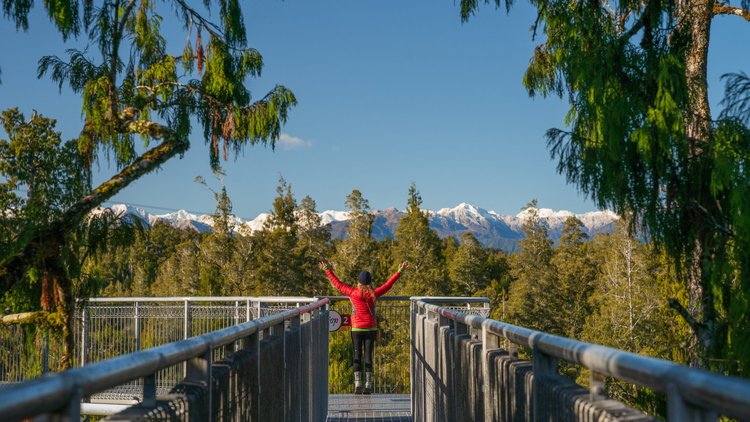
West Coast Treetop Walk & Tower Zipline
An exhilarating tree top adventure among temperate rainforest giants.
Learn more
Thrifty Hokitika Airport
Choose Thrifty for your vehicle hire needs - competitive rental rates, a fleet of modern 5 star ANCAP safety rated vehicles, convenient on-airport collection & a team of friendly, service-focused staff.
Learn more
Air New Zealand - Hokitika
Air New Zealand is New Zealand’s national carrier and the only airline which specialises in getting you to, from and around New Zealand.
Learn more
Shining Star Beachfront Accommodation
Supreme quality accommodation in Hokitika, right by the beach, overlooking the Tasman Sea.
Learn more
Hokitika Scenic Tours
Hokitika Scenic Tours offer specialised informative, sightseeing day and multi day tours and transport to any destination you wish to visit on the West Coast.
Learn more
Pioneer Hotel
If you want to experience old fashioned West Coast hospitality, you can't go past the Pioneer Hotel.
Learn more
Hokitika Sandwich Company
Fresh cut Sandwiches made to order with quality local ingredients on the beautiful West Coast of New Zealand.
Learn more
Hans Bay – Lake Kaniere Campsite
Large, grassy lake-front campsite beside beautiful Lake Kaniere. Take in the stunning landscape and explore the area.
Learn more
252 Beachside Motels & Holiday Park
Adjacent to beach and glow worm dell. Swimming pool (in season). Free Wifi
Learn more