

Westport & Buller Walks
WESTPORT & BULLER WALKS
Westport — a bustling town perched between a dramatic coastline, hill country and mountain ranges — is the perfect base ‘camp’ for the many walking and hiking trails throughout the surrounding Buller district.
Take a short walk, follow a hiking trail or a tramping track to discover wild seascapes and rivers, gentle rainforests, deep canyons and curious wildlife, or learn about days gone by on heritage trails to historic landmarks.
CAPE FOULWIND WALKWAY & SEAL COLONY
Dramatic coastal headland, NZ fur seals and lighthouse
An easy walk from sheltered Tauranga Bay leads to viewing platforms overlooking the seal colony. The track continues along the cliff top to the historic Cape Foulwind lighthouse.
- 10 min or 1 hr 30 min return
- Easy, well formed trail

KAWATIRI COASTAL TRAIL, WESTPORT
Heritage trail, coastal wilderness, wildlife, wetlands
This new family-friendly trail for cyclists and walkers will soon connect Westport with Charleston via Carters Beach, Cape Foulwind and Tauranga Bay. Three sections are fully open with completion of six more sections during 2023/24.
- 19.5 km (final trail will be 55km)
- Easy, well formed trail

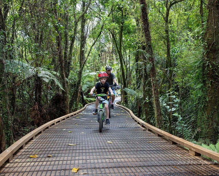
KAWATIRI RIVER TRAIL, WESTPORT
Forest and river trail to a lagoon and swimming beach
Walk (or bike) through a beautiful bush reserve, then follow the Buller-Kawatiri River to the fishing port and over a boardwalk to great views of Westport, the river and mountains. An optional loop track continues to a lagoon and beach.
- 4.5 km | 1 hr return
- Easy, well formed trail
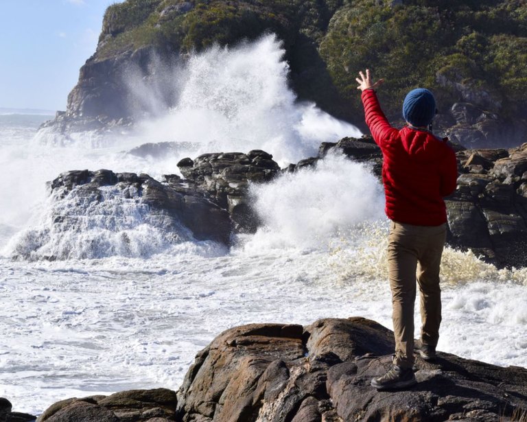
CONSTANT AND JOYCE BAYS, CHARLESTON
Coastal rock formations, ocean views
Charleston was once a busy gold mining community based around picturesque Constant Bay. The short loop walk above the historic harbour and stony beach leads to dramatic views of the ocean pounding against rocky cliffs.
- 15 min loop
- Easy, some exposed sections and drops
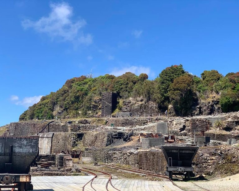
DENNISTON TOWN WALK
Circuit through an abandoned mining settlement
Walk back 100 years on the Denniston Plateau (18km northeast of Westport) on a short loop track through the once infamous 19th century coal mining settlement where families eked out a precarious living in extreme conditions.
- 1.3 km | 40 min loop
- Easy

BRAKEHEAD WALK, DENNISTON
Coal mining relics, dramatic views from top of Denniston Incline
Check out the remains of the infamous Denniston Incline — once known as the 8th engineering wonder of the world — with its heart-stopping downhill tracks and breathtaking views across the coastal plains to the Tasman Sea.
- 1.1 km | 40 min loop
- Easy

COALBROOKDALE WALK, DENNISTON
Historic coal mining tunnels and relics
Follow the historic cable-car rope road that carried coal from the mines to the top of the Denniston Incline. Relics include tunnels, foundations, a haulage winch and New Zealand’s best remaining example of a mine fanhouse.
- 2 km | 1 hr return
- Easy
BRITANNIA TRACK, DENNISTON
An uphill forest track, an abandoned gold mine
An old pack track climbs steadily through varied forest of rātā, rimu and kahikatea to the abandoned Britannia gold mine, complete with an impressive five-head quartz crushing battery and ancillary mining relics.
- 12 km | 4 hr return
- Easy

CURRENTLY CLOSED: DENNISTON BRIDLE PATH WALK
Uphill bush walk, coal mining relics, magnificent views
Nobody lives here any more but the infamous Denniston Plateau is still flush with old coal mining relics and the remains of the 19th century coal mining settlement. The steep bush walk up the old bridle path (the only access in days past) leads to the top of the renowned gravity-powered Denniston Incline and magnificent views of the coast below.
- 4.2 km | 5.5 hr return
- Steep slippery sections, creek crossings
- Recommended for hikers with a good level of fitness
- Check DOC website for an update on track status

CHARMING CREEK NORTH WALKWAY, SEDDONVILLE
Bush tramway route to historic mines and sawmills, Mangatini Falls
Walk along an abandoned bush tramway through a forested gorge to spectacular views of the 25-metre high Mangatini Falls. Pass through old railway tunnels, over bridges, past the relics of old coal mines and sawmills.
- 11 km | 4hr return
- Easy walking track
- Note: Charming Creek is not currently accessible from the southern end (Charming Creek South Walkway) which starts near Ngakawau.

THE OLD GHOST ROAD, SEDDONVILLE
An old gold miners’ trail, 21 bridges, 4 ghost towns
In Kahurangi National Park, this epic backcountry adventure travels through forested valleys, along steep alpine ridges, beside roaring rivers, via ghost towns and multiple bridges, between the rugged Upper Buller Gorge and coastal plains north of Westport.
- 85 km | 5 days
- Intermediate grade
ABOUT WEST COAST WALKS
For more detailed and up-to-date information on routes, conditions and essentials needed for walks, please visit the Department of Conservation website. There is a dedicated page for each walk or tramp, and advice on what to wear and take with you.


